CRMP Project Slide Show

Historical Photos

Restoration Photos

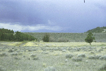
  The downstream face of Dwinnell Dam as it appeared in 1992. The Montague Irrigation District Canal (dry at the time of the photo) seen at the left in the photo delivers water stored in Lake Shastina for agricultural and urban uses to the east side of the Shasta Valley near Montague. This main ditch is over 20 miles long!
  Historical Photo 14

[ Home - FAQ - Shasta River Tour - Slide Show ]
[ Bibliography - Links - Contact ]

This site was made possible by grants from the California Dept. of Fish and Game
and the U.S. Fish and Wildlife Service

These pages look best in version 4+ of either Netscape or Internet Explorer

Copyright © 2000 Shasta River CRMP
Site created by SnowCrest Web Design